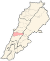
Bhamdoun
Bhamdoun
بحمدون | |
|---|---|
 Bhamdoun | |
| Coordinates: 33°48′35″N 35°39′19″E / 33.80972°N 35.65528°E | |
| Country | Lebanon |
| Governorate | Mount Lebanon Governorate |
| District | Aley District |
| Time zone | UTC+2 (EET) |
| • Summer (DST) | +3 |
Bhamdoun (Arabic: بحمدون), is a town in Lebanon 23 km (14 mi) from Beirut on the main road that leads to Damascus and in the suburbs of the main tourist city of Aley, lying at an altitude of 1,150 m (3,770 ft) above the Lamartine valley.
Geography
Two separate villages compose the town, Bhamdoun-el-mhatta (literally meaning "Bhamdoun the station") and Bhamdoun-el-day'aa ("Bhamdoun the village").
A railroad used to link Bhamdoun to Beirut with the train station being a prominent feature of the town for many years. The station and railroad were eventually abandoned when cars became more popular.
History
During the 1860 civil conflict in Mount Lebanon, the Druze spared the village of Bhamdun from attack, due to appeals of the resident American missionary to prevent violence.[1]
Tourism
Before the Lebanese civil war, Bhamdoun was one of Lebanon's most renowned and favorite summer resorts. Today, the town has regained some of its past tourism industry as most of its hotels, restaurants and entertainment centers have been renovated or rebuilt. Tourists, especially from Kuwait and the Persian Gulf region spend their summer vacation in Bhamdoun. Kuwaiti citizens own more than 30% of the properties in Bhamdoun Station since the 1950s. A branch of Kuwait Airways and the National bank of kuwait reopened in 2001.
The town also contains the Safir Hotel, Four Points Hotel by Sheraton, Carlton Hotel, Alsheikh Hotel and many others.
Religion
Bhamdoun has seven churches, two mosques built by Kuwaitis[citation needed], and the Bhamdoun synagogue. There are four Greek Orthodox churches, two Maronite, one Protestant but was not reconstructed after the war, and Druze Khalwa. Most of the population is Orthodox Christian, but there also is a large Druze and Maronite minority with a smaller Sunni Muslim one.
The Bhamdoun synagogue, built in 1910,[2] was one of three grand synagogues in Lebanon. It was abandoned shortly before the civil war which started in 1975, but the shell of the structure still stands.[3][4]
Wine
In 2000, a winery called Chateau Belle-Vue began planting vines, creating few jobs in the village. It began producing wine in 2003. The "Renaissance 2003" blend that it produced won the International Spirits and Wine Competition's Gold Medal Best in Class award in 2005.[5]
Climate
| Climate data for Bhamdoun, elevation 1,130 m (3,710 ft) | |||||||||||||
|---|---|---|---|---|---|---|---|---|---|---|---|---|---|
| Month | Jan | Feb | Mar | Apr | May | Jun | Jul | Aug | Sep | Oct | Nov | Dec | Year |
| Mean daily maximum °C (°F) | 10.1 (50.2) |
10.3 (50.5) |
12.6 (54.7) |
16.7 (62.1) |
20.7 (69.3) |
24.1 (75.4) |
25.7 (78.3) |
26.3 (79.3) |
23.7 (74.7) |
21.2 (70.2) |
17.0 (62.6) |
12.3 (54.1) |
18.4 (65.1) |
| Daily mean °C (°F) | 6.9 (44.4) |
7.0 (44.6) |
9.1 (48.4) |
12.8 (55.0) |
16.7 (62.1) |
20.1 (68.2) |
21.7 (71.1) |
22.2 (72.0) |
19.3 (66.7) |
17.1 (62.8) |
12.6 (54.7) |
9.1 (48.4) |
14.6 (58.2) |
| Mean daily minimum °C (°F) | 4.5 (40.1) |
4.5 (40.1) |
6.0 (42.8) |
9.3 (48.7) |
12.8 (55.0) |
15.8 (60.4) |
17.6 (63.7) |
18.1 (64.6) |
15.6 (60.1) |
13.6 (56.5) |
10.6 (51.1) |
6.8 (44.2) |
11.3 (52.3) |
| Average precipitation mm (inches) | 302 (11.9) |
262 (10.3) |
194 (7.6) |
95 (3.7) |
40 (1.6) |
1 (0.0) |
0 (0) |
0 (0) |
3 (0.1) |
54 (2.1) |
132 (5.2) |
239 (9.4) |
1,322 (51.9) |
| Source: FAO[6] | |||||||||||||
References
- ^ Makdisi, Ussama Samir (2000). The Culture of Sectarianism: Community, History, and Violence in Nineteenth-Century Ottoman Lebanon. Berkeley: University of California Press. p. 140. ISBN 978-0-520-21845-1.
- ^ Parfitt, Tudor, Israel and Ishmael: Studies in Muslim-Jewish relations, Page 89, St. Martin's Press 2000
- ^ "Img_5415". 23 August 2009.
- ^ "Img_5417". 23 August 2009.
- ^ "Chateau Belle-Vue".
- ^ "World-wide Agroclimatic Data of FAO (FAOCLIM)". Food and Agriculture Organization of United Nations. Retrieved 21 December 2024.
Further reading
- Salibi, Kamal (October 1997), Bhamdoun: Historical Portrait of a Lebanese Mountain Village (PDF), Oxford: Centre for Lebanese Studies, ISBN 1-870552-490

